Our Cycling Trip Through the Rockies
We left from Osoyoos on May 21st. Tricia (my wife) and I
had little idea what to expect. Less than 1/2 hour into the trip, we started
to ascend what we later learned is called Anarchist Pass. We climbed for
about 90 minutes, sweat and tears shed on the way.
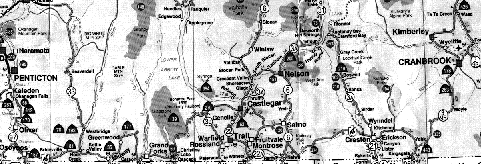
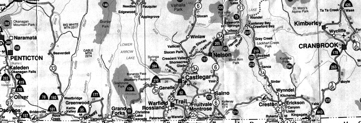
Our plan was to cycle along Hwy 3, through Grand Forks, Castlegar, Salmo,
Creston and then Cranbrook (map, 180
kb GIF). But when we got to Castlegar, we were told that we could avoid
the Kootenay Pass (1774 metres... highest in BC) by taking Hwy 3A through
Nelson and across a ferry (the longest free ferry ride in North America).
We're glad we did. Nelson is a cool city. The movie "Roxanne", with Steve
Martin, was filmed there. We even went to see the fire station that is
in the movie.
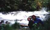 |
| Lockhart Creek |
We had more than our share of rain. In fact, while we were in Cranbrook,
it rained all night, and we woke up to face a cold, wet day. It was cold
enough to turn the rain to sleet. We pulled off the road to re-evaluate
our plan for the day. We decided to hitch-hike as far away from the foul
weather as we could. It was the first time either of us had hitch-hiked.
But before I could even raise my thumb, a man in a VW Westfalia camper
van stopped and asked us if we wanted a ride. We took that ride for about
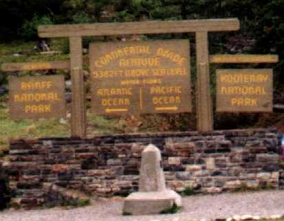
200km, right into Banff (across the Continental Divide). We even saw a
brown
bear (at a distance) from the van. Thanks, Larry, wherever you are!
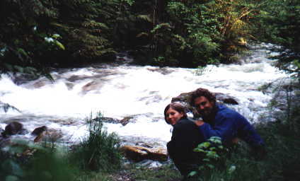
 |
| The Continental Divide |
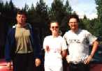 |
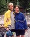
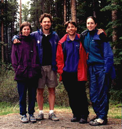
| Chris, Jen and me (Jeff) |
Just before we got to Creston, we met another cyclist named Chris (an internet
software programmer from Ottawa), on his way across Canada. We cycled with
him for a couple days. In a small town called Yahk (just east of Creston),
we also met Jen (a woman from Brantford Ontario). She was driving to Alert
Bay to work and have a fresh start on the west coast.
 |
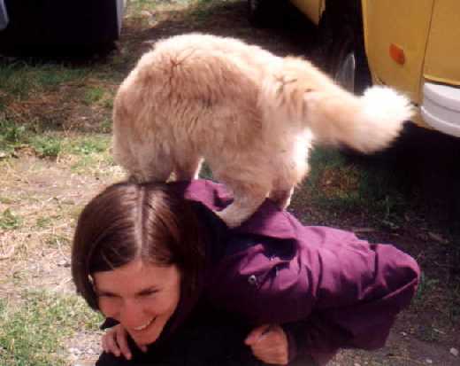
Friendly Cat
(on Tricia's back) |
We have two cats at home. We took them to their aunt's place while we were
travelling. One of the hardest things about the trip was being away from
our cats. So, whenever we saw cats, we didn't hesitate to get our feline
fix. This cat lives at the Rampart Creek Youth Hostel, about 70km south
of the Columbia Icefields.
 |
 |
| Richard and Amy |
Tricia, Jeff, Jordan
and Jessica |
Also at the Rampart Creek Hostel, we met Richard and Amy. They are on their
honeymoon, cycling from Kamloops, down the Icefields
Parkway, and possibly down to Montana. They went to UBC (as did Tricia
and I). In fact, Richard is studying dynamical systems, which is my area
of specialty. Amy just finished a degree in geology, and will be going
to med. school at McMaster University.
We met another couple from UBC. Jordan and Jessica just finished their
bachellor degrees in bio. chem. and are both going into med. school at
UBC. Jessica's father is Uli Haussmann, a math professor that I worked
with at bit at UBC.
 |
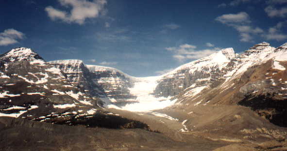
| Athabaska Glacier |
Luckily, we had a nice sunny day when we visitted the Columbia Icefields.
We took the SnoCoach tour. A SnoCoach is a specialized bus with huge wheels
that can handle the terrain of a glacier, including an 18o incline...
the steepest commercial road in North America. The SnoCoach was fun, but the
average age on the bus was about 60, so for those younger people I would
suggest the 3-hour hike tour instead. The tours didn't start until mid-June,
so we had no choice. We stood on the Athabaska glacier for a photo.
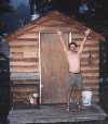 |
 |
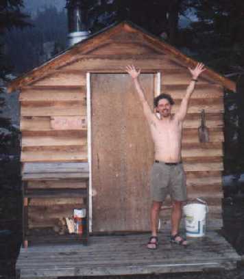
Wood-burning Sauna
at Hilda Creek |
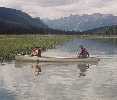
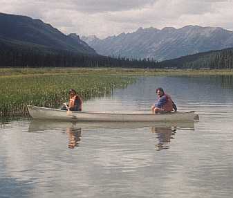
Canoeing at
Beauty Creek |
The Youth Hostels along the Icefields Parkway are deemed "rustic", but
in my opinion, better than the crowded hotel-type hostels in the bigger
cities. Some of them have wood-burning saunas. All of them have a spirit
of natural beauty. You can't tell in the photo, but it was snowing lightly.
The Hilda Creek Hostel is 8km south of the Columbia Icefields, at an elevation
of around 2000m. The Beauty Creek Hostel has a canoe that you can use.
Tricia and I took it out for a spin. Here's
me at the stern of the canoe.
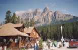 |
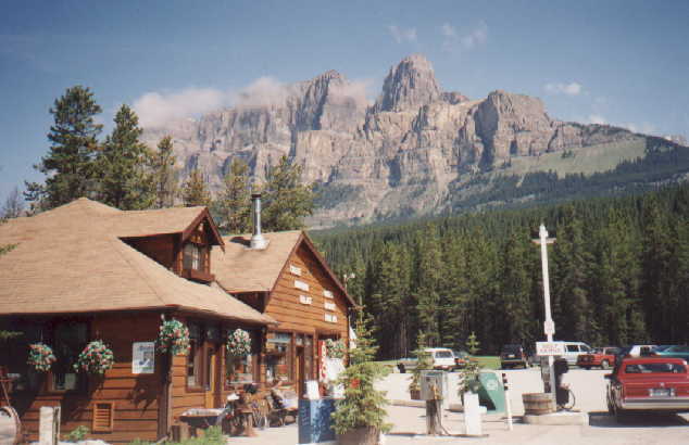
| Castle Junction |
I think the best picture I took during the trip was this one, taken at
the Castle Junction, where the Trans-Canada Hwy meets the Icefields Parkway
(half way between Banff and Lake Louise).
In the background is Castle Mountain. Tricia is sitting by her bike in
front of the building.
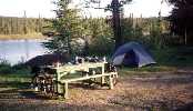 |
| Typical Campsite |
 |
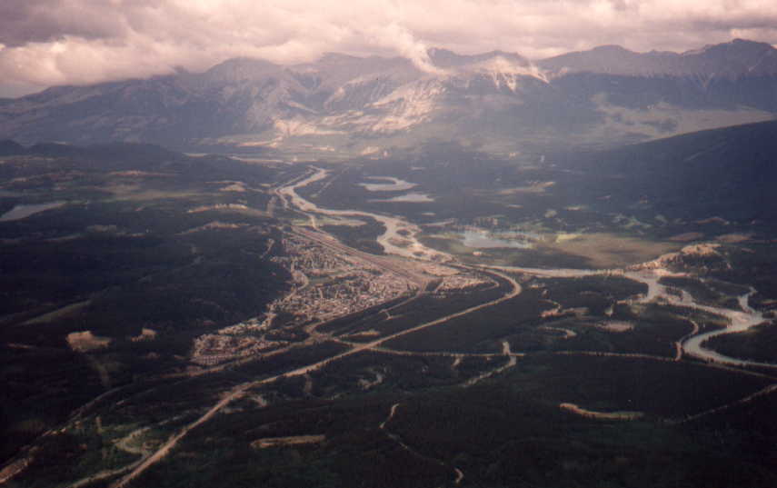
| Jasper |
We saw lots of different wildlife, including elk,
and mountain goats. Especially
around Jasper. When we got to Jasper, we took the tramway up to the summit
of Whistlers Mountain. The ride to the base of the tramway was a brutal
3km uphill grind. Very steep. But the view from the top of the tramway
was worth it.
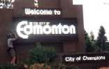 |
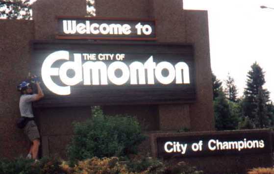
| Finally! |
After Jasper, we had about 5 days of cycling east on the Yellowhead Highway
(Hwy 16). The Rocky Mountains quickly disappeared into the horizon behind
us, and we were in the foothills. Many people told us about the tough hills
we would encounter before Edmonton, one of which took us over the highest
point of the Yellowhead. Well, the hills that materialized were nothing
compared to those that we tackled in the Rockies (Bonanza Pass was the
worst). The highest elevation on the Yellowhead is 1163m. Jasper is at
about 1035m, and Edmonton I would guess is around 700m. The "Welcome to
Edmonton" sign was a sight for sore eyes... make that legs.
Our specific destination was the home of our good friends, Colleen
Stewart and Terry Rolston. They are a goofy couple. And reality pretty
much gets checked at the door when Tricia and Colleen are together.
Here is a picture of Terry
and Colleen just on their way out the door to go to work.
In all, we pedaled just over 1200km, and hitch-hiked about 200km. Our
average speed was around 22km/h... slower in the mountains, and faster
in the foothills.
Page by Jeff and Tricia.


